 |
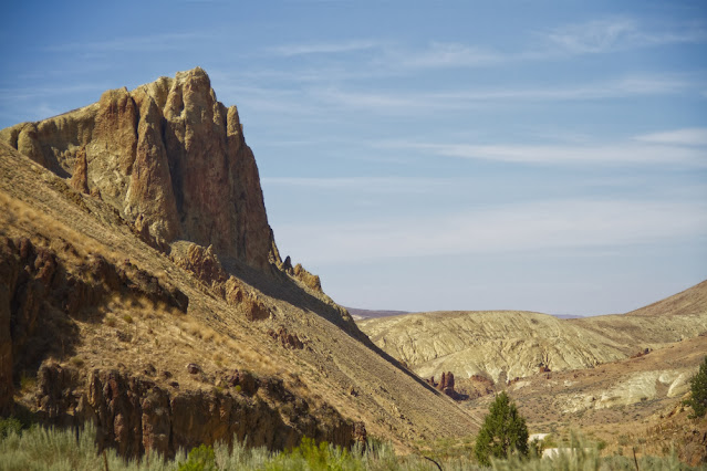
| Rico passes beyond the confluence of Dago Gulch and Leslie Gulch. |
Perched at the head of Leslie Gulch, I try to temper my anticipation. I also put on the best poker face I have at my disposal and try to minimize any role I might have played in lobbying for this excursion during the planning stages of this trip. I’m keenly aware of the let-down I felt at The Pillars of Rome and if this turns out to be a bust, I’m hoping I won’t be blamed.
If you were to start researching Leslie Gulch today, you might find positively spun comments like, “...Situated amongst one of the most stunning landscapes in Oregon…” or “...one of the most jaw-dropping geological formations in the Pacific Northwest…”
But you can also find more tempered expressions like, “But of all these non-disappointments Leslie Gulch, by far, has been the most impressive.”
One comment, because of its awkward placement within its respective article reflected a positively cynical perspective. “Things to do near Leslie Gulch…” it began, “Visit Boise, Idaho.” it finished unapologetically. .
The Leslie Gulch road is a seven and a half mile spur that terminates at a boat ramp - a boat ramp that itself is meant to terminate in the waters of the Owyhee Reservoir… and sometimes does. The road is smooth and seems tame yet an indelible message imprinted in my brain from reading the Gulch’s literature is a warning not to get stuck at the end of the road when it starts to rain. Rain has only ever seemed like fiction on this trip, but after a moment’s reflection, it does seem evident that this current landscape would be well suited to exist as a flash-river tributary, given enough moisture.
 |
| USGS, Dean B. Vander Meulen - USGS Open File Report 98-77 |
To travel over greater distances efficiently, we’ve been skimming across the high plateaus, a haven where it’s possible to trace near straight lines. Nothing in the gradual descent toward Leslie Gulch has suggested anything other than a benign environment. Yet an overview of the area as interpreted by geologists shows that for some fraction of an hour, we have already been driving in the mouth of the vast Mahogany volcanic caldera. Sure, we already associate calderas with volcanoes, but geologist Ellen Bishop points out that Yellowstone is a caldera and few people would recognize that they are on, “the flat slopes of a huge, dangerously active volcano.” In fact, if I understand correctly, it may be that 15 million years ago, the same hotspot that powers the volcanism at Yellowstone today may have been under Southeast Oregon - our continental plate acting like a slow inevitable conveyor belt.
In the image above, I’ve tried to place the margins of the Mahogany Caldera onto Google Earth. The overlain rectangle within the margins encompasses the entire Leslie Gulch spur.
Bishop, in her book In Search of Ancient Oregon explains that, “Instead of building a cone, calderas spread their eruptions far afield as a turbulent cloud of hot gas and ash that often moves at 60-100 miles an hour. Such eruptions produce flat and extensive ignimbrite deposits.”
The word ignimbrite doesn’t mean anything to me so it was helpful to find that it was coined from the Latin words meaning ‘fire’ and ‘rain’. So ‘firerain’ fell from the sky to form this land. Where the firerain was heavy and hot, it melted together, and where it was dispersed, less so. Meanwhile, neighboring calderas contributed to the layers, sprinkling, dusting or pyroclastically flowing ignimbrite, tuff and ash layers until volcanic materials lay 1000 feet deep.
 |
| Figure taken from Geology of the Mid-Miocne Rooster Comb Caldera and Lake Owyhee Volcanic Field, eastern Oregon: Silicic volcanism associated with Grande ronde flood basalt. Benson & Mahood. |
These images unfold in chronological order as you ultimately draw to the edge of the reservoir.
___
___
___
___
___
___
The Owyhee River Reservoir did not appear to be fulfilling the function of a reservoir.
The broad valley had, over time, become merely a record of graduated water levels.
What was left of the river threatened to slowly soak into the thickening silt.
Rico sought out the best extant pools and cast bait into the turbid water, always seeking data on the availability of fish.
If there were fish in there, they were non-responsive (I should note that the one-handed fishing style that Rico is employing here would provide an excellent opportunity for a beer product placement …if only we had a suitable sponsor.)
But we needn’t limit sponsorship options to the manufacturers of beer beverages. It occurred to me that this scene might be an excellent opportunity to show off, for instance, a board game - one of those complicated ones with large unusually shaped die…or cards…or place-mats and napkin rings or crystal punch-bowls…or Solo cups…or….
Once more we feel the turning of the Earth nudging us to find the night’s campsite.
…to be continued.
Do you need to catch up with the narrative? All the previous parts are available via these links:
PART 1: Hawaii, Owyhee...uh, Boglands (Part One)
PART 2: Hawaii, Owyhee...uh, Böglands (Part Two)
PART 3: Hawaii, Owyhee...uh, Boglands (Part Three)
PART 4: Hawaii, Owyhee...uh, Boglands (Part Four)
PART 5: Hawaii, Owyhee...uh, Boglands (Part Five)
And the next part is now available at:


No comments:
Post a Comment