Showing posts with label I-84. Show all posts

Tuesday, September 26, 2017

Eagle Creek Fire: Out of Sight, out of mind.


Several days of rain have driven parts of the Eagle Creek Fire into quiet bouts of seething resentment. But here and there unexpectedly — absent any ventilating breeze — tell-tale plumes of smoke reveal hiding places where glowing embers yet lurk under blankets of ash. According to wildfiretoday.com, the fire is only 46% contained, but one would never suspect it while traveling the gorge corridor confined to SR-14.


I took a picture of this sign, wondering where my balls went. Meanwhile half a dozen bicyclists pulled down the orange safety barrier and pedaled out to the end of the viewpoint.

Curiosity about the state of the gorge after wildfire ran rampant across its vertical faces inspired me to seek access to the trails and viewpoints along I-84 along the Oregon side of the gorge, but the eastbound lanes were still closed on Friday. I drove the back way into Corbett, hoping to find some unguarded route into the post-fire scenery, but every road I tried, sooner or later, ended in a roadblock or fence.  


The road to the Vista House was blocked off.  Even the Portland Women’s Forum State Scenic Viewpoint was fenced off, so I had to hike along the guardrail at the edge of the rural thoroughfare, looking for vantage points through the ‘shrubberies’ to catch glimpses of the iconic landmark (that looked distinctly untouched by fire) all the while listening for the approach of monster pickup trucks careening around corners at speeds possible only for locals intimately familiar with the route and the likely location of speed traps.

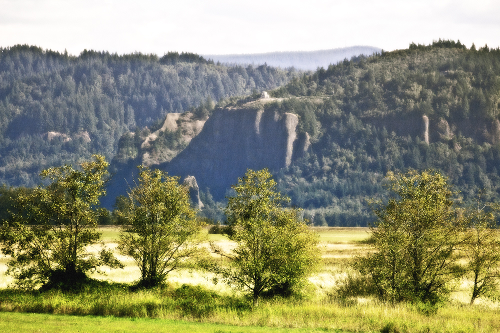
From this viewpoint, the gorge looks largely pristine, save for the singed trees on Archer Mountain on the Washington side (Upper left), the one spot where the fire was able to jump the Columbia.


Crown Point (Vista House) as it appears from Steigerwald Lake National Wildlife Refuge, Washington.

Sunday, the weather was warm and sunny and the air was fairly clear. 

Landscape obscured by rain and clouds

I took yet another trip up SR-14 to survey the gorge since last week’s trip in the rain wasn’t very informative.


Once again, I’m including this picture from 2010 for comparison purposes.

Click on image to view larger version

This is how the gorge looks as of Sunday the 24th. The pictures were taken closer to the middle of the day instead of toward evening, so I was better able to see where the fire had left its marks. Even though the smoke was minimal, there was still a haze in the air which kept my images from being their sharpest. 

Using the long lens to shoot across the gorge often resulted in a bluish tint to my pictures which sometimes made it difficult to distinguish between burnt and un-burnt trees, so I’ve taken steps to compensate for this — sometimes at the cost of color fidelity.


Straight across from my Cape Horn vantage point is the feature known as Angel’s Rest. It is one of the few places I was able to easily identify, partly because I’m familiar with the Angel’s Rest trail. Video from news helicopters has caused local news anchors to describe Angel’s Rest as 'toast', and the video footage shows sobering images of the trail’s switchbacks climbing through what looks like an apocalyptic landscape.


I don’t have a helicopter.


In this image, you can make out the switchbacks at lower middle(ish).


To be fair, this picture of Angels Rest that I took from my kayak back in August of 2009 shows that this isn’t the first time that the area has been subjected to fire


Another view taken in April, 2010


It looks like maybe Bridal Veil Falls fared well.


But the fire may have had some impact at Bridal Veil Falls State Park. It’s hard to tell whether I’m looking at singed trees or hints of autumn.


Looking upriver, Archer Mountain’s singed trees stick out at upper left.


A closer view of Archer Mountain from St. Cloud Recreation Area.


The St. Cloud Day-Use Area was formerly somebody's apple orchard. Those who require insights into the nature of gravity would do well to slumber beneath the fruit laden branches here.


As inviting as some of the apples appear, apple maggot quarantine signs trigger my suspicions.


I made my way down to the edge of the river at the St. Cloud Recreation Area. The following pictures show the sometimes surprising mix of burnt and unburnt trees across the river, a pattern that fire officials have been describing as a mosaic.


It seems like the folks at Cascade Locks were pretty lucky.


Homeward bound, I chose not to cross the bridge at Hood River (because I didn’t have any change for the toll) even though I-84 W had been open for several days. Instead, I followed SR-14 back the way I came…


…beneath a waxing moon…


Last Sunday, in the rain, fire was burning all the way down to I-84 somewhere in between Wyeth and Starvation Creek State Park.  Today, however, from my Washington vantage point, I was unable to see any evidence of fire. The landscape beneath Starvation Ridge formed a striking triangle shape, something I hadn’t ever appreciated before. 

Westbound traffic was lined up and at a standstill, perhaps the result of weekend adventurers postponing their return to the working week—until the very last minute. 

Monday, January 28, 2008

FROZEN WATER / FROZEN TIME @ Multnomah Falls

How it looked Saturday Morning

Midweek, I saw a picture of Multnomah Falls in the Oregonian (Portland’s big daily newspaper) that showed the giant waterfall as a kind of hybrid water/ice sculpture and decided I’d try to see it for myself if daily temperatures would agree to stay close to the freezing range until the weekend.


Multnomah Falls is situated toward the west end of the Columbia River Gorge, an eighty mile long canyon that stretches east through the Cascade Range. This high walled ‘funnel’ turns out to be an excellent conduit for frigid arctic winds that seek an avenue to the Portland Metropolitan area.

Anticipating ice, I stopped at REI Friday night and picked up some traction devices that are supposed to allow a person to walk on ice. There were three options, but the two in my price range were All Purpose Traction Aids by Due North and the Yaktrax Walker. I chose to try the Due North offering since I couldn’t see how the little metal bands on the Yaktrax wouldn’t slip on solid ice. I thought maybe the Monkey-cam could test-drive the Yaktrax, but he had spent the night bar hopping with Picasso in Old town and couldn’t be persuaded to wake up.

I’ve begun to think that Monkey-cam’s deliberate hangovers are really just an excuse he manufactures to avoid going hiking in the cold since he steadfastly refuses to wear pants. Last week I finished knitting a little non-confining ‘hat’ for his disproportionately large berries. When I gave it to him, he tried to act appreciative, but he looked kind of embarrassed and he’s never worn it. Now I guess I know how my grandma felt after she sewed me a hippie shirt.


Early Saturday morning - really early - I noted that internet weather sites were listing winter storm warnings for the Columbia River Gorge. The snow and freezing rain weren’t expected until about 10 o’clock. I thought maybe I’d be able to hike in at daybreak and get out before the storm’s onslaught.

Multnomah Falls is a pretty big deal as far as tourist sites go. It’s the kind of place you can take your relatives from Kansas who’ve never seen geography more interesting than a plain. It is easily accessible from an island parking facility in between the west and east bound lanes of interstate 84.

The clouds were approaching in an ominous fashion, disguised perhaps like fog, but with their baggy pants hanging low and their gang colors showing. A preliminary vanguard of little ice pellets fell from the sky and bounced on the ground.

I didn’t think I could beat the establishing pictures of the falls that I’d already seen in the newspaper, so I hustled up to the bridge and tried to take some more detailed images. The mist that came from still unfrozen, falling water single-mindedly sought the surface of my lens and immediately started to collect and freeze on the lens hood.

Taking pictures from the bridge was proving to be a losing proposition. I stood there among half a dozen other would-be photographers, all of us distinguished by our self-conscious maneuverings of cheap gangling tripods. I felt like some kind of lemming confined to a cage.


The waterfall mist had, over the last few days, coated the bridge and the trail in multiple layers of solid ice. The grasses and vegetation around the punch bowl were growing elaborate ice flags that pointed toward free flowing water. Nobody was moving beyond the bridge because the upward slanting trail was clearly a functional ice-slide.

I sat on a bench and pulled the Due North traction devices out of my pack. It was as easy as pulling on slippers to fit them to the bottom of my boots. All told, there were only six little tungsten spikes on each sole, but that turned out to be as effective as magic. The spikes made a satisfying crunching noise as they bit into the ice. This aural and tactile feedback helped make me confident the little spikes were engaged and working with each step I took.

It’s about a mile to the top of the falls that you can see from the bridge, and I walked that mile in solitude. As I climbed in elevation, I noted that the once visible Columbia River was disappearing into a white-gray fog. The ice pellets I noted earlier hadn’t stopped falling. I couldn’t tell by looking if they were falling faster or not, but the noise the bouncing pellets made when they hit the paved trail allowed for a rough estimate based on audible volume – like listening to a Geiger counter.


The stream that feeds Multnomah Falls is supposedly fed by underground springs from Larch Mountain - and also rain. The water careens around corners and bounds over rocks in a headlong plunge toward the canyon rim where it launches itself into space.

This frenetic motion of the water – this activity – is the best evidence or proof for the passing of time. In a way, winter appears to stop time. Animals enter various states of suspended animation. Grass stops growing. Trees shed their leaves and loose their link to the life giving sun. Water freezes.

In the still areas of the stream, ice would find footholds and crystal fingers would reach out to claim a branch or a rock – to stop the vital motion – the flow – the pulse - and bury it beneath frigid covers.


I don’t know where this apple came from - Well, O.K., I bet it came from an apple tree, but like I said, there didn’t seem to be anyone else on the trail. In a landscape of black and white and gray and green, I liked the surprising spot of red.


Now and then, the background noise of the freezing pellets falling from the sky would swell and amplify till it sounded like the ocean. The rocks began to shine and glisten.

As careful as I tried to be - protecting my camera from precipitation with an unwieldy umbrella - an ice coating never-the-less began slowly spreading from the lens hood down the length of the lens barrel and eventually began interfering with the zoom ring.


It was cold out, but I felt fine as long as I kept moving. When I stopped to take pictures I would also take time to drink from my thermos which I had filled with a hot cocoa - dark rum concoction suggested by the Monkey-cam. Three cups of steamy goodness later, I was feeling much braver about walking on the ice than was probably warranted.


One of the benefits of having a digital camera is the opportunity it affords for reviewing pictures as soon as they are taken. Unfortunately, the differential between the sub-freezing ambient temperature and my rum-stoked core temperature in excess of 98.6 degrees Fahrenheit rendered my bifocals next to useless. I had to unzip my coat and find a dry patch of material to wipe the glasses, and then I had to put them on quickly and review pictures before they fogged up again. I determined that I liked the longer exposures though I don’t know if I can explain why.

It has something to do with multiple layers of frozenness.

Maybe I’m unduly susceptible to metaphor. Winter attempts to freeze and capture the stream. Cuffs of ice are everywhere visible. The camera shutter opens and shuts capturing a limited moment. But the stream is somehow, even now, not yet frozen.

The stream begins to disappear. It leaves a trace of its pattern, a memory of its motion. The stream is ephemeral - fleeting – as long as it moves it transcends the frozen moment.


I began to feel comfortable in my high private sanctuary from time. Meanwhile, far below, in random moments of chaos in the realm of a winter storm, cars careen across lanes and bound into medians. They leave patterns of their passing – angry ruts torn into a rich brown earth, white ash from a sputtering red flare, a human body – motionless. A freeway closed between Hood River and Troutdale.


Featured Post

EVOLVING ROADS: Car camping with Kip and Rico (Part One)

I don’t know how it started for sure. Some intrepid band of Homo sapiens maybe walked over a land bridge from Russia or navigated the seas i...

POPULAR POSTS

The Narrative Image NAVIGATION AID