
Several days of rain have driven parts of the Eagle Creek
Fire into quiet bouts of seething resentment. But here and there unexpectedly —
absent any ventilating breeze — tell-tale plumes of smoke reveal hiding places
where glowing embers yet lurk under blankets of ash. According to
wildfiretoday.com, the fire is only 46% contained, but one would never suspect
it while traveling the gorge corridor confined to SR-14.

I took a picture of this sign, wondering where my balls
went. Meanwhile half a dozen bicyclists pulled down the orange safety barrier and
pedaled out to the end of the viewpoint.
Curiosity about the state of the gorge after wildfire ran
rampant across its vertical faces inspired me to seek access to the trails and
viewpoints along I-84 along the Oregon side of the gorge, but the eastbound
lanes were still closed on Friday. I drove the back way into Corbett, hoping to
find some unguarded route into the post-fire scenery, but every road I tried,
sooner or later, ended in a roadblock or fence.

The road to the Vista House was blocked off. Even the Portland Women’s Forum State Scenic
Viewpoint was fenced off, so I had to hike along the guardrail at the edge of
the rural thoroughfare, looking for vantage points through the ‘shrubberies’ to
catch glimpses of the iconic landmark (that looked distinctly untouched by fire)
all the while listening for the approach of monster pickup trucks careening
around corners at speeds possible only for locals intimately familiar with the route
and the likely location of speed traps.
From this viewpoint, the gorge looks largely pristine, save
for the singed trees on Archer Mountain on the Washington side (Upper left),
the one spot where the fire was able to jump the Columbia.

 |
| Crown Point (Vista House) as it appears from Steigerwald Lake National Wildlife Refuge, Washington. |
Sunday, the weather was warm and sunny and the air was
fairly clear.
 |
| Landscape obscured by rain and clouds |
I took yet another trip up SR-14 to survey the gorge since last
week’s trip in the rain wasn’t very informative.

Once again, I’m including this picture from 2010 for
comparison purposes.
 |
| Click on image to view larger version |
This is how the gorge looks as of Sunday the 24th.
The pictures were taken closer to the middle of the day instead of toward
evening, so I was better able to see where the fire had left its marks. Even
though the smoke was minimal, there was still a haze in the air which kept my
images from being their sharpest.
Using
the long lens to shoot across the gorge often resulted in a bluish tint to my
pictures which sometimes made it difficult to distinguish between burnt and
un-burnt trees, so I’ve taken steps to compensate for this — sometimes at the
cost of color fidelity.

Straight across from my Cape Horn vantage point is the feature
known as Angel’s Rest. It is one of the few places I was able to easily
identify, partly because I’m familiar with the Angel’s Rest trail. Video from news
helicopters has caused local news anchors to describe Angel’s Rest as 'toast', and
the video footage shows sobering images of the trail’s switchbacks climbing
through what looks like an apocalyptic landscape.

I don’t have a helicopter.

In this image, you can make out the switchbacks at lower
middle(ish).

To be fair, this picture of Angels Rest that I took from my
kayak back in August of 2009 shows that this isn’t the first time that the area
has been subjected to fire

Another view taken in April, 2010

It looks like maybe Bridal Veil Falls fared well.

But the fire may have had some impact at Bridal Veil Falls
State Park. It’s hard to tell whether I’m looking at singed trees or hints of
autumn.

Looking upriver, Archer Mountain’s singed trees stick out at
upper left.

A closer view of Archer Mountain from St. Cloud Recreation
Area.

The St. Cloud Day-Use Area was formerly somebody's apple orchard. Those who require insights into the nature of gravity would do well to slumber beneath the fruit laden branches here.

As inviting as some of the apples appear, apple maggot quarantine signs trigger my suspicions.

I made my way down to the edge of the river at the St. Cloud
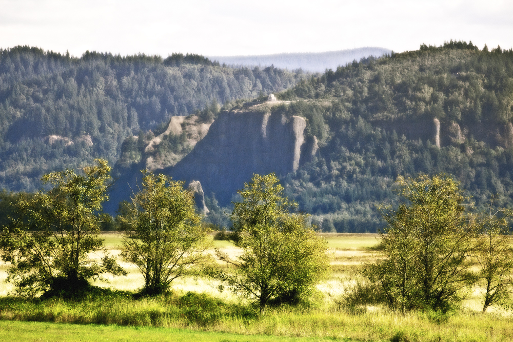
Recreation Area. The following pictures show the sometimes surprising mix of burnt
and unburnt trees across the river, a pattern that fire officials have been
describing as a mosaic.


It seems like the folks at Cascade Locks were pretty lucky.

Homeward bound, I chose not to cross the bridge at Hood
River (because I didn’t have any change for the toll) even though I-84 W had
been open for several days. Instead, I followed SR-14 back the way I came…

…beneath a waxing moon…

Last Sunday, in the rain, fire was burning all the way down
to I-84 somewhere in between Wyeth and Starvation Creek State Park. Today, however, from my Washington vantage
point, I was unable to see any evidence of fire. The landscape beneath
Starvation Ridge formed a striking triangle shape, something I hadn’t ever appreciated
before.
Westbound traffic was lined up and at a standstill, perhaps the result
of weekend adventurers postponing their return to the working week—until the very last minute.


