Showing posts with label Vista House. Show all posts

Tuesday, September 26, 2017

Eagle Creek Fire: Out of Sight, out of mind.


Several days of rain have driven parts of the Eagle Creek Fire into quiet bouts of seething resentment. But here and there unexpectedly — absent any ventilating breeze — tell-tale plumes of smoke reveal hiding places where glowing embers yet lurk under blankets of ash. According to wildfiretoday.com, the fire is only 46% contained, but one would never suspect it while traveling the gorge corridor confined to SR-14.


I took a picture of this sign, wondering where my balls went. Meanwhile half a dozen bicyclists pulled down the orange safety barrier and pedaled out to the end of the viewpoint.

Curiosity about the state of the gorge after wildfire ran rampant across its vertical faces inspired me to seek access to the trails and viewpoints along I-84 along the Oregon side of the gorge, but the eastbound lanes were still closed on Friday. I drove the back way into Corbett, hoping to find some unguarded route into the post-fire scenery, but every road I tried, sooner or later, ended in a roadblock or fence.  


The road to the Vista House was blocked off.  Even the Portland Women’s Forum State Scenic Viewpoint was fenced off, so I had to hike along the guardrail at the edge of the rural thoroughfare, looking for vantage points through the ‘shrubberies’ to catch glimpses of the iconic landmark (that looked distinctly untouched by fire) all the while listening for the approach of monster pickup trucks careening around corners at speeds possible only for locals intimately familiar with the route and the likely location of speed traps.

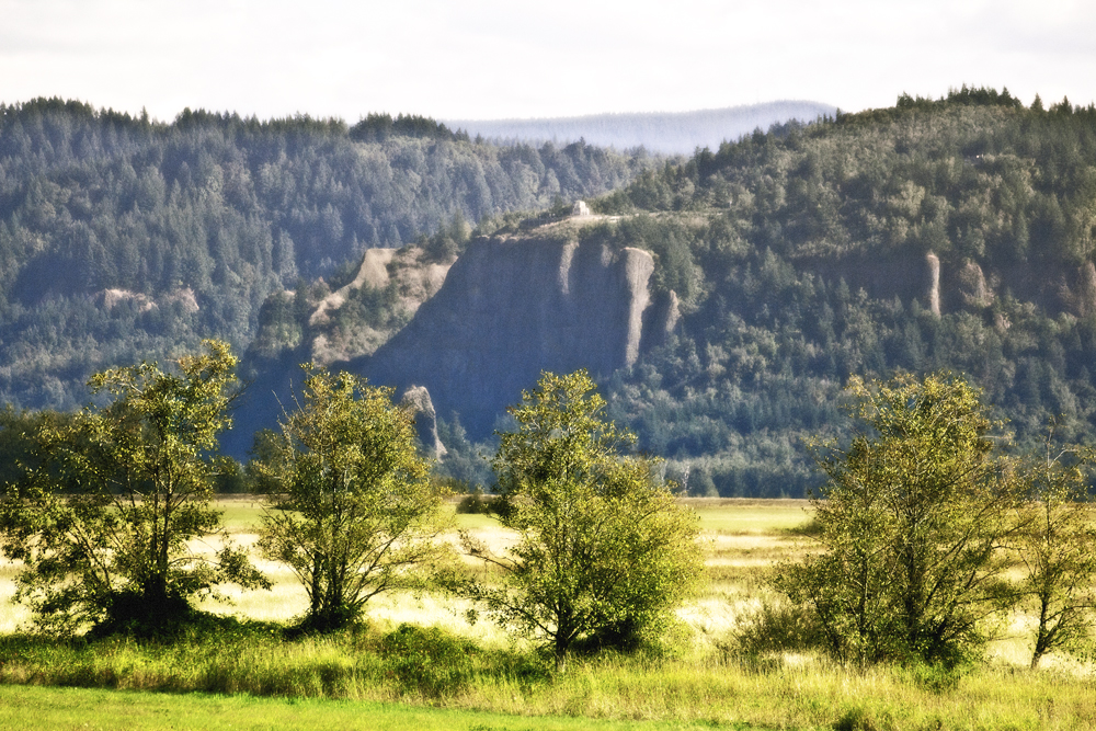
From this viewpoint, the gorge looks largely pristine, save for the singed trees on Archer Mountain on the Washington side (Upper left), the one spot where the fire was able to jump the Columbia.


Crown Point (Vista House) as it appears from Steigerwald Lake National Wildlife Refuge, Washington.

Sunday, the weather was warm and sunny and the air was fairly clear. 

Landscape obscured by rain and clouds

I took yet another trip up SR-14 to survey the gorge since last week’s trip in the rain wasn’t very informative.


Once again, I’m including this picture from 2010 for comparison purposes.

Click on image to view larger version

This is how the gorge looks as of Sunday the 24th. The pictures were taken closer to the middle of the day instead of toward evening, so I was better able to see where the fire had left its marks. Even though the smoke was minimal, there was still a haze in the air which kept my images from being their sharpest. 

Using the long lens to shoot across the gorge often resulted in a bluish tint to my pictures which sometimes made it difficult to distinguish between burnt and un-burnt trees, so I’ve taken steps to compensate for this — sometimes at the cost of color fidelity.


Straight across from my Cape Horn vantage point is the feature known as Angel’s Rest. It is one of the few places I was able to easily identify, partly because I’m familiar with the Angel’s Rest trail. Video from news helicopters has caused local news anchors to describe Angel’s Rest as 'toast', and the video footage shows sobering images of the trail’s switchbacks climbing through what looks like an apocalyptic landscape.


I don’t have a helicopter.


In this image, you can make out the switchbacks at lower middle(ish).


To be fair, this picture of Angels Rest that I took from my kayak back in August of 2009 shows that this isn’t the first time that the area has been subjected to fire


Another view taken in April, 2010


It looks like maybe Bridal Veil Falls fared well.


But the fire may have had some impact at Bridal Veil Falls State Park. It’s hard to tell whether I’m looking at singed trees or hints of autumn.


Looking upriver, Archer Mountain’s singed trees stick out at upper left.


A closer view of Archer Mountain from St. Cloud Recreation Area.


The St. Cloud Day-Use Area was formerly somebody's apple orchard. Those who require insights into the nature of gravity would do well to slumber beneath the fruit laden branches here.


As inviting as some of the apples appear, apple maggot quarantine signs trigger my suspicions.


I made my way down to the edge of the river at the St. Cloud Recreation Area. The following pictures show the sometimes surprising mix of burnt and unburnt trees across the river, a pattern that fire officials have been describing as a mosaic.


It seems like the folks at Cascade Locks were pretty lucky.


Homeward bound, I chose not to cross the bridge at Hood River (because I didn’t have any change for the toll) even though I-84 W had been open for several days. Instead, I followed SR-14 back the way I came…


…beneath a waxing moon…


Last Sunday, in the rain, fire was burning all the way down to I-84 somewhere in between Wyeth and Starvation Creek State Park.  Today, however, from my Washington vantage point, I was unable to see any evidence of fire. The landscape beneath Starvation Ridge formed a striking triangle shape, something I hadn’t ever appreciated before. 

Westbound traffic was lined up and at a standstill, perhaps the result of weekend adventurers postponing their return to the working week—until the very last minute. 

Sunday, June 12, 2011

TOURIST for a DAY: Portland and Environs


Mr. ‘T’ travels the world. Armed with a sophisticated, lightweight point and shoot, he documents his travels in the tradition of the best travel photographers. By that I mean, when you look at Mr. ‘T’s travel photos, they provoke a profound sense of wanderlust.

Sometimes it makes me jealous. Why am I not disciplined enough to earmark money for travel? Why don’t I go to more beautiful, exotic places?  But then Mr. ‘T’ mused, “Someday I’d like to photograph Portland a bit like I was a tourist.”


That’s when I was reminded that I actually live in a beautiful, exotic place, and the only reason I don’t notice is because I see it every day. So we agreed to meet after work and try to view our city as if we were visitors.


This is what the south portion of downtown Portland looks like from a vantage point high in Big Pink, the U.S. Bancorp tower. A similar view can be attained by visiting Portland City Grill on the 30th floor. I know this sounds stupid, but for the first time, as I looked at our city pushed to the edge of the river by the West Hills, I think I really began to understand the term, Willamette Valley. From a vantage point looking north, we could track the progress of rain clouds as they filed in from the west, and watched one briefly as it paused at the confluence of the Willamette and Columbia before heading on up the gorge.


So you’d think that a city called Portland would be a land of many ports, but while we certainly have a Port of Portland that entertains ocean going vessels, we’re really named after Portland, Maine. And if a coin flip between the founding fathers of ‘Portland’ had gone the other way, we’d be called Boston.


Pioneer Courthouse square – Portland’s Living Room.


There’s a bronze sculpture (public art) of a man carrying an umbrella and hailing a taxi in Portland’s living room. Since the man with the umbrella is as still as a statue, this poorly (puzzlingly?) placed grape is actually relatively safe. On this day, I find the wing-tips the most pleasing part of the sculpture. Having practiced the process of casting bronze, I briefly consider how I would have achieved this degree of realism and reminisce about my teacher’s cast naked chicken.


One of a pair of guardian lions perches before the gate to Portland’s version of Chinatown.


Powell’s Books is a really big non-virtual bookstore. There are actually books inside that you can pick up and read. Outside is a sculpture that looks like it sprang from the mind of a troubled Dr. Seuss.


This fountain was dedicated to the memory of Stephen Skidmore in 1888 and Henry Weinhard offered to make it flow with free beer (probably for just that first day) but the city incomprehensibly declined.


Reflection of Big Pink in typical Portland puddle.


I didn’t know I needed bacon topped maple bars until a colleague brought some to work. The downtown Voodoo Doughnut location is currently closed for remodeling, but it looks like this new sign is ready to go. The last time I tried to buy a doughnut here, I had to run a gauntlet of homeless people who determined, perhaps rightly, that people who shop for decadent doughnuts must have discretionary disposable income. Either that or homeless people like voodoo doughnuts too.


Back at the beginning of 2008, Oregon was considered one of the most ‘unchurched’ states in America with 24 percent of us claiming no religious identification. This makes Oregon a ripe destination for missionaries. Some religious people might now be encouraged to discover that Oregon no longer leads the nation in this regard, but I don’t think it’s because of the efforts of evangelicals, rather, it’s just that Vermont jumped up to 34%.


It always looked to me like Portlandia should be throwing dice.


This sculpture is officially called The Quest.
But the unofficial names seem more accurate:
"Three Groins in a Fountain" (though there are two more figures on the other side)
"The Grope"
"The Quest for the Breast"
"Family Night at the YMCA"


I looked at this building and saw a building. Mr. “T” looked at this and noted Escher like qualities. So I took a second look and tried to transcend my slavish devotion to narrative and find a pleasing texture/pattern/design…


…and tried again at the Ira Keller Forecourt Fountain…


…but backslid into a narrative about catharsis by the time I encountered the Thompson Elk statue and fountain.


An iconic Benson Bubbler: Free flowing Bull Run water throughout the downtown area.


Speaking of Bull Run water, here is one of the Mt. Tabor open reservoirs that have so far not had any positive Cryptosporidium tests.


Mt. Tabor isn’t actually downtown, but it does have a nice park built on top of it even though it is an extinct (hopefully) volcano. Of course, we thought Mt. St. Helens was kind of extinct too.


Sometimes you can get pretty nice views of Portland from the top of Mt. Tabor. But honestly, I can’t say it’s a big tourist destination.


Rocky Butte - same deal as Mt. Tabor. A small shield volcano - but this one is situated closer to the Columbia and provides views of the airport, interstate 205 disappearing into Washington, and interstate 84 pointing east toward the Columbia Gorge.


The Vista House. An Iconic stop on the old scenic highway.


There are a lot of scenic waterfalls and hiking trails in the Columbia Gorge and it has proven to be very popular with tourists. Many of these features appear on The Narrative Image’s Hike Directory Page (see the tabs at the top of the page) 


But it is also interesting to stop and tour Bonneville Dam to see how we continue to search for the balance between satisfying our need for energy with the obvious need to preserve the very resource we are plundering.


There was evening, and there was morning – another day?

Featured Post

EVOLVING ROADS: Car camping with Kip and Rico (Part One)

I don’t know how it started for sure. Some intrepid band of Homo sapiens maybe walked over a land bridge from Russia or navigated the seas i...

POPULAR POSTS

The Narrative Image NAVIGATION AID