Thousands of years of
human exploits ought to be recorded around here, but the roads that native
Americans pioneered, or earlier, the 'highways' employed by whoever it was that
thought traveling across a cold land-bridge from Russia was a great idea, have
either been reclaimed by the ocean or been paved over by opportunistic
Europeans.
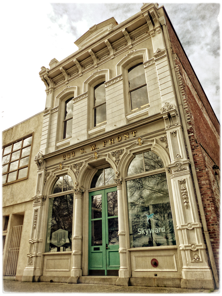 |
| Prominent in this image is the Fechheimer & White building (approximately 131 years old). The smaller building just to the left is the Hallock-McMillan building, thought to be Portland's oldest existing commercial building (maybe 159 years old). |
The oldest buildings in
 |
| A small architectural accouterment at the North end of reservoir #1 on Mt. Tabor. |
There is no Acropolis on
 |
| 01 |
Just half an hour from the boundaries of our modern city, the landscape quickly becomes indistinguishable from what we imagine primordial forests might look like, if primordial forests had patchworks of clear-cuts. I guess it isn't surprising that in watersheds where clouds simply sink into the creased landscape, keeping the shadow-lands perpetually wet, painted messages (if any) run off rock, their colors dispersing in rivulets of rain and condensation, human memories transmogrified into mineral supplements for moss and mushrooms.
 |
| 12 |
Red oxides accent evidence of human encroachment otherwise obscured by creeping vines and mosses.
 |
| 02. Memaloose Road Bridge |
So it is intriguing to read of abandoned water works on a tributary of the Clackamas river. To give credit where credit is due, I first read about the South Fork Clackamas/Memaloose Falls hike in a post by Shane Kucera at Outdoorproject.com.

There was enough
information to get me to the trailhead...

...though the effects of a forest fire have resulted in the closure of the road that leads to it, which adds a little over a mile of uphill-walking to the mileage tally.
 |
| 03 |
The first time I went, I found the ropes left behind by previous benevolent trailblazers, but when I took Sgt. Rock, we overshot and ended up straying too far South.
 |
| 04 |
The terrain is steep and
the brush thick.
 |
| 06 |
But
watching Sgt. Rock bound up steep hills,

...much
like a deer,
 |
| 05 |
...helped
me appreciate his value as a forward scout.
 |
| 07 |
We found more information
about the hike from a post at OregonHikers.org by Brian Edwards. When there was
another break in the weather, we found the ropes leading into the canyon. From
there, following the trail is pretty straightforward.
 |
| 08 |
This tunnel is in close
proximity to Memaloose falls.
 |
| 09 |
 |
| 10 |
Past the tunnel, I went off trail and descended down to the base of the falls. Meanwhile, Sgt. Rock previewed the rest of the trail.
 |
| 11 |
Sgt. Rock was able to confirm that the trail was passable all the way to the
 |
| 28 |
So the next time the rain let up, we assaulted the trail by river, thus cutting out the mile long climb to the trailhead (thanks once again to the luv2kayak evangelical outreach).
 |
| 13 |
An incongruous fire
hydrant.
 |
| 14 |
Tunnels along the way.
 |
| 15 |
Lower
falls on the South Clackamas fork. Note the pipeline just to the right of the falls.
 |
| 16 |
Valves and wheels along
what looks like a stone retaining wall mark (perhaps) where pipelines from
Memaloose Creek and the South Fork Clackamas converge.
 |
| 17 |
The Memaloose Creek pipeline crosses just below the convergence of Memaloose Creek and the South Clackamas Fork. A short distance up the trail are the remains of what some have called a settling pool. Watch that last step off the bridge headed East.
 |
| 18 |
This is the end of the long tunnel that leads to the top of the big falls where the diversion dam is located. The last tunnel is long and the floor is dominated by a deteriorating elevated wooden walkway featuring plenty of pointy things that could easily enter your skull cavity through your eye-socket if you should happen to trip in the dark. I recommend a reliable artificial light source.
 |
| 19 |
 |
| 20 |
 |
| 21 |
 |
| 22 |
Headed
back down to the high bridge.
 |
| 23 |
Notes about the bridge:
If it's wet, it's very, very slippery.
At the end of February, it was rated at a load
capacity of 280 pounds...one way. |
| 24 |
The detour around the high
bridge is short, and in comparison, relaxing.
 |
| 25 |
 |
| 26 |
Constrained by time, we
commandeer giraffes to cover more of the harsh terrain before the sun sets. For provisions, we carry plenty of 3 species tacos.
 |
| 27 |
Possible bigfoot sighting.

Approximate positions of
numbered photos
Brown dots = trip A
Yellow dots = trip B
Red dots = trip C


