Showing posts with label Leslie Gulch. Show all posts

Monday, September 4, 2023

Hawaii, Owyhee...uh, Böglands (Part Seven)

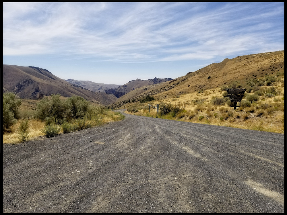
Our eight-wheeled convoy skitters from the gulch and confidently negotiates a gossamer web of roads that evolved over time - shaped by topography, territory, and tepid human encroachment.


This instant in time - this fragile iteration of topsoil and flora tied to the sky and the distant oceans is even now responding to disparate fingers -


Water vapor flows - an atmospheric river streams in the sky


This image was chosen for its analogous visual relationship to the next picture. Ramona Falls (pictured) is not actually in the Owyhee Canyonlands.

Water falls - water flows - gravity is


Earth is a fitful sleeper. She tosses and turns. Her skin cracks and buckles. She bleeds magma and farts ashes that settle in layers through the epochs.


Rain turns the pages - shows us chapters of the past - reveals secrets of creation - and nightmares of extinction.


The earth murders whole worlds, and tries to bury the evidence. And we stumble onto fresh stages to strut and fret, as if the world was new...and signified everything.


Wind-driven, sandy, nutrient-poor soil accumulates on the latest mantle of basalt. Migrating seeds find purchase and sprout, then, with prickly fingers, comb more dust and silt out of the sky - compounding their interest.


Yet even as an ecosystem evolves in this interlude of benign geologic activity, decay, erosion, and entropy are poking and prodding and disassembling.

We have passed from one drainage system into another. We can speculate that maybe, beneath our feet, the materials for some future Leslie Gulch lie assembled and ready to be carved. Yet, as we gain impressions of the canyon opening before us - as we look across broad valleys to the encompassing layer cake upon which the high plateaus lie, it is hard to attribute this sculpted landscape to the puny creek that trickles down its throat.


Mud and gravel fall.


Mud and gravel flow. Gravity is…(gravity is by far, the weakest of the four fundamental forces, so they say.)


A creek of succor pokes along the desert cliff
And octopus roots, like so many straws
Suck life into the trunks, the branches, the whispering leaves
To build a sheltering green lean-to against the sheer stone
A cool oasis that profits even those who are not trees
Nature’s beauty is undeniable
And I am among the first to celebrate
But I have been smashing fish unconscious with rocks
And inexpertly tearing fillets from their skeletons – that is
I have been a lucky tight-rope walker – luckier than some fish –
Reclining in today’s benevolence, yet feeling measured by
The gaze of trees


We set up a new base camp at Succor Creek State Natural Area. There are maybe 18 places to camp that are dispersed on each side of the creek. There is a vault toilet on the way in. You have to bring your own beverages unless you can filter water out of the creek…and I’m betting you can’t - well, I mean you probably can. But time is money and so are filters (If only there was a sponsor who could provide a refreshing beverage in situations like this and wanted flattering photos of their product in ‘lifestyle’ type images.)


Photo Credit: Kip

 In this picture, Kip accomplishes something rare. It appears that all of us are smiling mostly natural smiles. Part of the reason I’m smiling is because I’m sitting on a bench. This is the only furniture I’ve sat on so far besides the car seats because not only did I forget my sleeping bag, I also forgot my camp chair.


I set about preparing my bacon-wrapped, cheese-stuffed jalapenos. I was inspired to make these as a homage to the stuffed jalapenos I first tasted at Wanker’s Corner Saloon. Normally I grill these, but I lost my grill and my favorite hat when I flipped my kayak over by not negotiating a simple riffle on the Umpqua River. Pan frying turns out to be an acceptable alternative and, as a bonus, it doesn’t burn the toothpick tips off which results in fewer surprises and medical trauma down the road.


Then Rico broke out a bottle of a very fine bourbon he’d been saving for the occasion and I think we drank quite a lot of it, though my memory becomes imprecise at this point.


I rapidly lost the ability to conversationalate and found myself focusing on maybe a specific way a leaf was shimmying at the end of a twig, or the way a sunbeam illuminated an ice cube. I listened to the words coming out of Rico and Kip but it felt like a warm syrup and besides, I had no waffles. The shadows slowly changed their aspect, shifting across the canyon walls. Later, a whale came floating up the road past our camp. It smiled and gave me a subtle nod, like a cowboy would if he were wearing a hat, but it didn’t say anything. It just slowly drifted on by - making good eye contact with that huge eye. It was so graceful. It was also so unexpected. I turned to see if Rico or Kip had seen it but they were all like, haven’t you ever seen a whale before?

Even later, a middle-aged man approached the camp. He appeared to be looking for something. He greeted us, rather shyly, and asked, “Have you seen my whale drift by here? I’ve lost it.” Rico and Kip both just pointed up the road.


Even later, I was disturbed by a tap, tap, tapping noise. A man and a woman with hammers and crowbars had climbed the scree slopes below the cliffs and were treating the rock surfaces as personal percussion instruments. When they finally came down they explained that they were collecting thunder eggs. The man spilled his knapsack to reveal an impressive haul of baseball-sized geodes.


My dreams were both vivid and hard to remember.


There was something about the hero’s journey (Hercules and the gross of juniper berries).


There was something about my own mortality - being one with the landscape - ashes to ashes


Something about the Earth being alive.


Later still, I tried once again to take a shot of the Milky Way, still longing to achieve a technically competent shot. Bats squeaked in the dark and made impossible turns before the light of the stars. It occurred to me that I might still be dreaming, perhaps in the same predicament as Chuang Tzu who dreamed he was a butterfly, or wondered in retrospect if maybe he wasn’t really a butterfly dreaming he was a man.

So I asked, “Hey Kip, Rico,” pausing briefly to make sure I had their attention, “did you guys really see a whale?”
“Didn’t you?” they asked like a Greek chorus.

That bourbon was strong medicine.


To be continued…

The rest of this narrative can be accessed via these links:

PART 1: Hawaii, Owyhee...uh, Boglands (Part One)


PART 2: Hawaii, Owyhee...uh, Böglands (Part Two) 


PART 3: Hawaii, Owyhee...uh, Boglands (Part Three) 


PART 4: Hawaii, Owyhee...uh, Boglands (Part Four)


PART 5: Hawaii, Owyhee...uh, Boglands (Part Five)


PART 6: Hawaii, Owyhee...uh, Boglands (Part Six)

Wednesday, August 30, 2023

Hawaii, Owyhee...uh, Böglands (Part Six)

Rico passes beyond the confluence of Dago Gulch and Leslie Gulch.


Perched at the head of Leslie Gulch, I try to temper my anticipation. I also put on the best poker face I have at my disposal and try to minimize any role I might have played in lobbying for this excursion during the planning stages of this trip. I’m keenly aware of the let-down I felt at The Pillars of Rome and if this turns out to be a bust, I’m hoping I won’t be blamed.

If you were to start researching Leslie Gulch today, you might find positively spun comments like, “...Situated amongst one of the most stunning landscapes in Oregon…” or “...one of the most jaw-dropping geological formations in the Pacific Northwest…”

But you can also find more tempered expressions like, “But of all these non-disappointments Leslie Gulch, by far, has been the most impressive.”

One comment, because of its awkward placement within its respective article reflected a positively cynical perspective. “Things to do near Leslie Gulch…” it began, “Visit Boise, Idaho.” it finished unapologetically. .


The Leslie Gulch road is a seven and a half mile spur that terminates at a boat ramp - a boat ramp that itself is meant to terminate in the waters of the Owyhee Reservoir… and sometimes does. The road is smooth and seems tame yet an indelible message imprinted in my brain from reading the Gulch’s literature is a warning not to get stuck at the end of the road when it starts to rain. Rain has only ever seemed like fiction on this trip, but after a moment’s reflection, it does seem evident that this current landscape would be well suited to exist as a flash-river tributary, given enough moisture.


USGS, Dean B. Vander Meulen - USGS Open File Report 98-77

To travel over greater distances efficiently, we’ve been skimming across the high plateaus, a haven where it’s possible to trace near straight lines. Nothing in the gradual descent toward Leslie Gulch has suggested anything other than a benign environment. Yet an overview of the area as interpreted by geologists shows that for some fraction of an hour, we have already been driving in the mouth of the vast Mahogany volcanic caldera. Sure, we already associate calderas with volcanoes, but geologist Ellen Bishop points out that Yellowstone is a caldera and few people would recognize that they are on, “the flat slopes of a huge, dangerously active volcano.” In fact, if I understand correctly, it may be that 15 million years ago, the same hotspot that powers the volcanism at Yellowstone today may have been under Southeast Oregon - our continental plate acting like a slow inevitable conveyor belt.


In the image above, I’ve tried to place the margins of the Mahogany Caldera onto Google Earth. The overlain rectangle within the margins encompasses the entire Leslie Gulch spur.

Bishop, in her book In Search of Ancient Oregon explains that, “Instead of building a cone, calderas spread their eruptions far afield as a turbulent cloud of hot gas and ash that often moves at 60-100 miles an hour. Such eruptions produce flat and extensive ignimbrite deposits.”

The word ignimbrite doesn’t mean anything to me so it was helpful to find that it was coined from the Latin words meaning ‘fire’ and ‘rain’. So ‘firerain’ fell from the sky to form this land. Where the firerain was heavy and hot, it melted together, and where it was dispersed, less so. Meanwhile, neighboring calderas contributed to the layers, sprinkling, dusting or pyroclastically flowing ignimbrite, tuff and ash layers until volcanic materials lay 1000 feet deep.


Figure taken from Geology of the Mid-Miocne Rooster Comb Caldera and Lake Owyhee Volcanic Field, eastern Oregon: Silicic volcanism associated with Grande ronde flood basalt. Benson & Mahood.


Now imagine a magician holding a featureless blob of multi-colored tuff before your eyes. Then he palms it. Shows you nothing up his sleeves save for millions of years of blazing hot summers, freezing cold winters, and seasonal rainstorms. Suddenly, the magician opens his hand and…Voilà, Leslie Gulch.


These images unfold in chronological order as you ultimately draw to the edge of the reservoir.


___


___


___


 ___


___


___


___


___
  

The Owyhee River Reservoir did not appear to be fulfilling the function of a reservoir.


The broad valley had, over time, become merely a record of graduated water levels.


What was left of the river threatened to slowly soak into the thickening silt.


Rico sought out the best extant pools and cast bait into the turbid water, always seeking data on the availability of fish.


If there were fish in there, they were non-responsive (I should note that the one-handed fishing style that Rico is employing here would provide an excellent opportunity for a beer product placement …if only we had a suitable sponsor.)


But we needn’t limit sponsorship options to the manufacturers of beer beverages. It occurred to me that this scene might be an excellent opportunity to show off, for instance, a board game - one of those complicated ones with large unusually shaped die…or cards…or place-mats and napkin rings or crystal punch-bowls…or Solo cups…or….


Once more we feel the turning of the Earth nudging us to find the night’s campsite.

…to be continued.

Do you need to catch up with the narrative? All the previous parts are available via these links:


PART 1: Hawaii, Owyhee...uh, Boglands (Part One)


PART 2: Hawaii, Owyhee...uh, Böglands (Part Two) 


PART 3: Hawaii, Owyhee...uh, Boglands (Part Three) 


PART 4: Hawaii, Owyhee...uh, Boglands (Part Four)


PART 5: Hawaii, Owyhee...uh, Boglands (Part Five)  


And the next part is now available at:

PART 7: Hawaii, Owyhee...uh, Boglands (Part Seven) 

Featured Post

EVOLVING ROADS: Car camping with Kip and Rico (Part One)

I don’t know how it started for sure. Some intrepid band of Homo sapiens maybe walked over a land bridge from Russia or navigated the seas i...

POPULAR POSTS

The Narrative Image NAVIGATION AID