
As near as I’ve been able to calculate, the red arrow points to our base of operations on the Owyhee River. This location is at the bottom end of about 48 miles of class II and III rapids - that is, if you happen to be there in the middle of May. If you’re there at the end of August and maybe during a season of drought, traveling by raft is rumored to be problematic.
Sitting in the shade, fishing and drinking beer is nice, but you can’t do it all day. Well, actually, you can do it all day, but we were also cognizant of other points of interest in the canyon.
One such site was archeological in nature, but the people who know of such sites tend to be protective of them - and for good reason.
 |
| (LEFT: pictogram peppered with bullet scars. RIGHT: Same image modified with Jon Harmon’s DStretch to better delineate the original art.) |
For instance, this antler man that appears near Maupin, Oregon appears to be the victim of fairly intensive target practice.
 |
| (TOP: Various carved images - a medallion, a humanoid figure and a sunburst all defaced with spray paint. BOTTOM: The same image modified with Jon Harmon’s DStretch reveals a layer of spray paint that betrays a more modern, angsty origin.) |
And these carved petroglyphs (also near Maupin) appear to have been covered in various layers of spray paint.
 |
| (Detail of the humanoid carving that appears beneath the ‘N’ in Tanya) |
 |
| (TOP: Original image of pictograms in Picture Gorge. Note graffiti scratched over the top. BOTTOM: The same image modified with Jon Harmon’s DStretch to better reveal the extent of the original pictograms.) |
And these Picture Gorge pictograms have likely been damaged by someone wielding a sharp rock as a scraping implement.
Because of the protective reticence to share indigenous rock-art sites, the search for such places becomes something of a puzzle…or a treasure hunt.

Fortunately, Rico is pretty good at teasing the details out of arcane archeological papers and texts…and matching such details to pertinent landmarks.

We end up at a spot that looks like it would have been a pretty nice camp for a slightly bigger, higher river. Perhaps the level area where we parked would have been a nice broad beach.

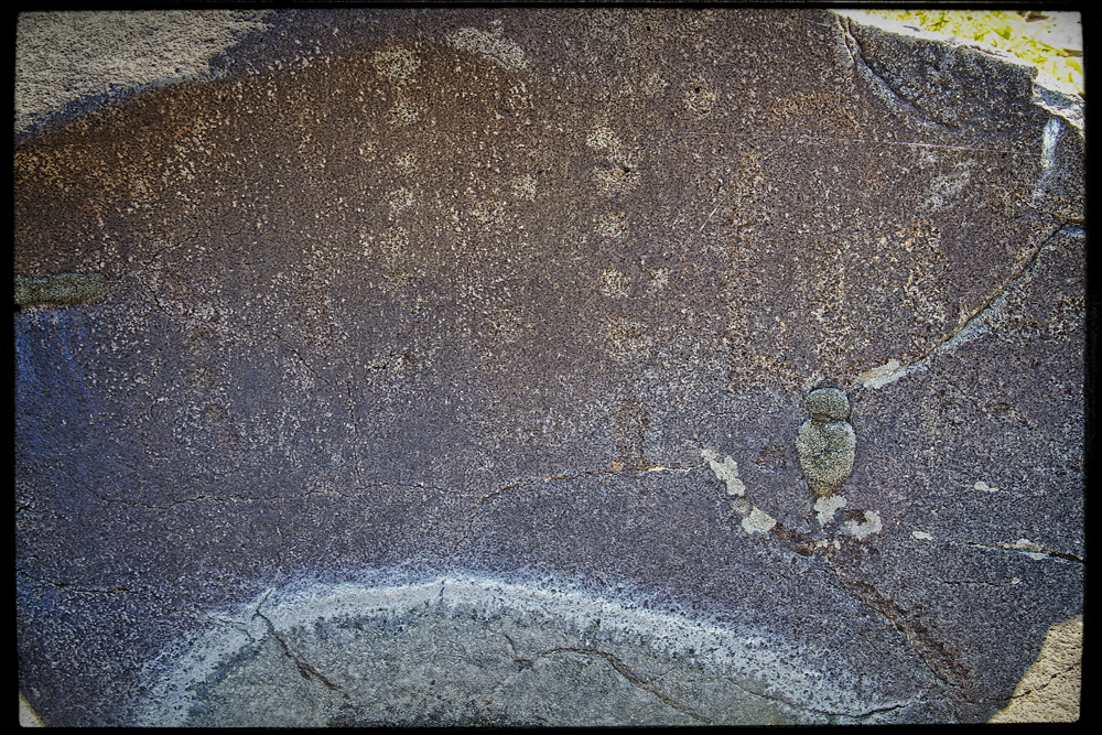
Nearby, a mound of earth features large river polished rocks. Some of these large boulders feature expansive flatish surfaces.

In some cases, it is possible to identify pecked markings - markings formed by the removal of the darker desert patina from the rock’s surface, leaving the lighter substrate to stand out as an intentional design (There may be a pecked oval shape in the center of the rock above).

Elsewhere, where the desert patina does not provide enough contrast, or the artist intended to make a more emphatic point, the pecked lines have been invested with more time and effort until they have become engraved.
I’ve broached the topic of rock art before: https://thenarrativeimage.blogspot.com/2013/11/a-mystery-wrapped-in-enigma-squeezed.html
…so without going on too much of a tangent, I’ll just say the mystery of it is perpetually tantalizing to me. It’s like finding a message in a bottle…but in a language nobody speaks anymore. How important is the message? Was it sent by someone facing death on a sinking ship? Did seven stranded castaways try to reveal the location of their island? Or is it just advertisements for some shady shaman’s latest herbal remedy or a pubescent youth’s love proclamation for his parallel ‘Tanya’?

Anthropomorphic figures seem to lend themselves to narratives, but it is hard to get beyond pure speculation. I want to know why someone felt it was worth their time to tap a stick figure into a rock next to the river. I try to imagine what the landscape looked like when the drawing was created. I wonder about the art’s placement on the rock. Is the figure obvious, like a sign? Or is the viewer required to climb to a more precarious viewpoint?
Then, while struggling to identify the patterns and the symbols, one must also guard against the tendency to see patterns where they don’t really exist. Am I looking at a meticulously rendered grid pattern, or is this just the way a crystalline basalt weathers over a thousand years?
I find the urge to interpret irresistible.

While this image is visible from the ground, I find I can get a more encompassing shot of it by climbing on top of the rock it’s on and standing. I don’t see it as an animal or humanoid. But maybe it depicts a road - a path - or maybe a map.
 |
| (LEFT: Rock-art. RIGHT: Google Earth map) |
Just for fun, I check out the landscape as depicted in Google Earth and compare it to the rock-art carving.

Other rocks perhaps carry tally-marks - the counting of specific events, or visits?


Here, a large boulder appears to have been carved into a big bowl. One explanation for this structure is that it is a pothole - a circular impression in the rock caused by turbulent swirling water that utilizes pebbles and sediments to abrade the rock. These often appear in flowing river beds and absolutely gigantic examples can be found up in central Washington in the landscapes carved by ice-age floods.

In fact, there were countless examples of carved out pot-holes on the Umpqua River.


(Shout out to Atomic Arts Theater Company for those 5 years when they did Star Trek in the Park - Scene from Journey to Babel.)


We can at least test that last one out by running a few experiments.


We head back to base camp as the sun approaches its apex.
 |
| (Photo Credit: Kip) |
At this point, we have been aware of a cluster of house-like buildings up river, but we don’t yet know if they are occupied. This time is as good as any to see if we have neighbors.


 |
| (Photo Credit: Kip) |
Back at camp, Rico uses his meat thermometer to give us some idea of how hot it is. Rather ominously, when the breeze blows, the temperature climbs a few degrees more. I begin to appreciate the culture(s) that came up with the idea of siestas.

 |
| (Photo Credit: Kip) |
Joyful patterns repeat (This is Kip’s stringer)


Do you need to catch up with the story? Then follow these links:
PART 1: Hawaii, Owyhee...uh, Boglands (Part One)
PART 2: Hawaii, Owyhee...uh, Böglands (Part Two)
PART 3: Hawaii, Owyhee...uh, Boglands (Part Three)


No comments:
Post a Comment