Wednesday, August 30, 2023

Hawaii, Owyhee...uh, Böglands (Part Six)

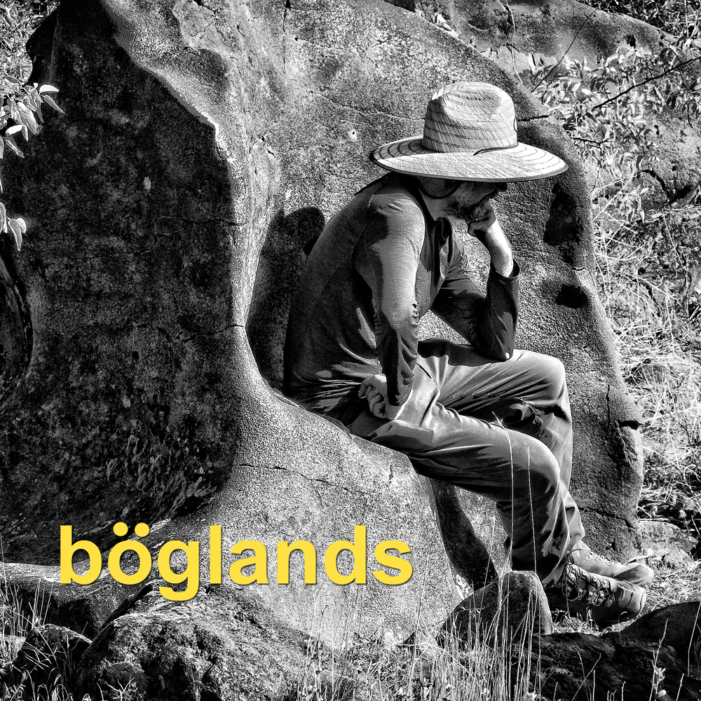
Rico passes beyond the confluence of Dago Gulch and Leslie Gulch.


Perched at the head of Leslie Gulch, I try to temper my anticipation. I also put on the best poker face I have at my disposal and try to minimize any role I might have played in lobbying for this excursion during the planning stages of this trip. I’m keenly aware of the let-down I felt at The Pillars of Rome and if this turns out to be a bust, I’m hoping I won’t be blamed.

If you were to start researching Leslie Gulch today, you might find positively spun comments like, “...Situated amongst one of the most stunning landscapes in Oregon…” or “...one of the most jaw-dropping geological formations in the Pacific Northwest…”

But you can also find more tempered expressions like, “But of all these non-disappointments Leslie Gulch, by far, has been the most impressive.”

One comment, because of its awkward placement within its respective article reflected a positively cynical perspective. “Things to do near Leslie Gulch…” it began, “Visit Boise, Idaho.” it finished unapologetically. .


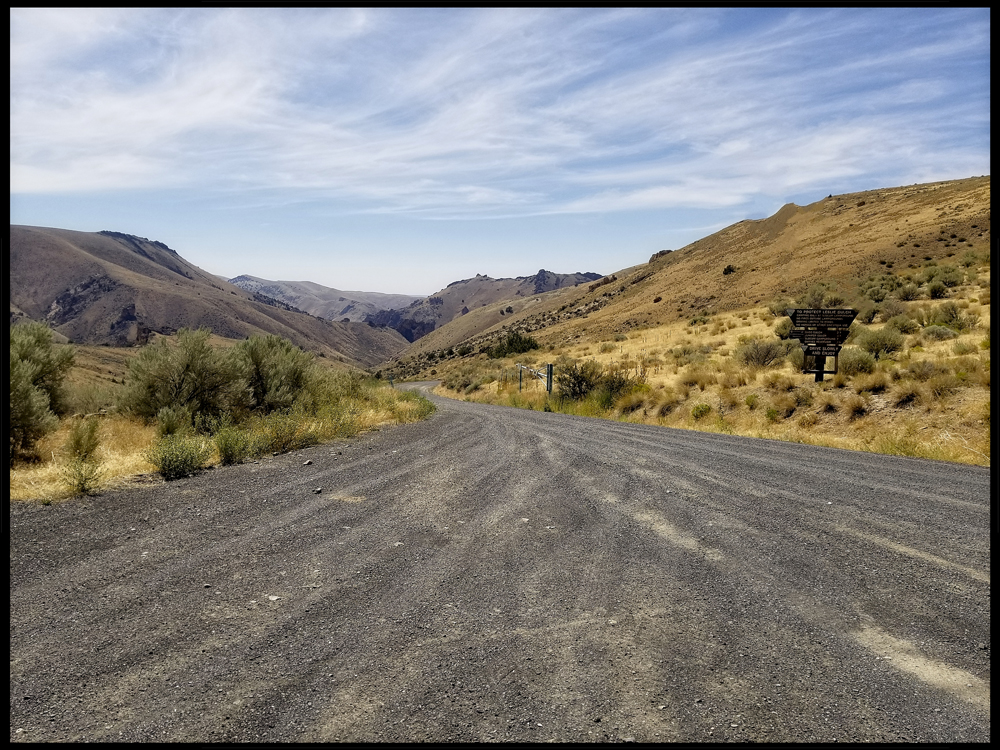
The Leslie Gulch road is a seven and a half mile spur that terminates at a boat ramp - a boat ramp that itself is meant to terminate in the waters of the Owyhee Reservoir… and sometimes does. The road is smooth and seems tame yet an indelible message imprinted in my brain from reading the Gulch’s literature is a warning not to get stuck at the end of the road when it starts to rain. Rain has only ever seemed like fiction on this trip, but after a moment’s reflection, it does seem evident that this current landscape would be well suited to exist as a flash-river tributary, given enough moisture.


USGS, Dean B. Vander Meulen - USGS Open File Report 98-77

To travel over greater distances efficiently, we’ve been skimming across the high plateaus, a haven where it’s possible to trace near straight lines. Nothing in the gradual descent toward Leslie Gulch has suggested anything other than a benign environment. Yet an overview of the area as interpreted by geologists shows that for some fraction of an hour, we have already been driving in the mouth of the vast Mahogany volcanic caldera. Sure, we already associate calderas with volcanoes, but geologist Ellen Bishop points out that Yellowstone is a caldera and few people would recognize that they are on, “the flat slopes of a huge, dangerously active volcano.” In fact, if I understand correctly, it may be that 15 million years ago, the same hotspot that powers the volcanism at Yellowstone today may have been under Southeast Oregon - our continental plate acting like a slow inevitable conveyor belt.


In the image above, I’ve tried to place the margins of the Mahogany Caldera onto Google Earth. The overlain rectangle within the margins encompasses the entire Leslie Gulch spur.

Bishop, in her book In Search of Ancient Oregon explains that, “Instead of building a cone, calderas spread their eruptions far afield as a turbulent cloud of hot gas and ash that often moves at 60-100 miles an hour. Such eruptions produce flat and extensive ignimbrite deposits.”

The word ignimbrite doesn’t mean anything to me so it was helpful to find that it was coined from the Latin words meaning ‘fire’ and ‘rain’. So ‘firerain’ fell from the sky to form this land. Where the firerain was heavy and hot, it melted together, and where it was dispersed, less so. Meanwhile, neighboring calderas contributed to the layers, sprinkling, dusting or pyroclastically flowing ignimbrite, tuff and ash layers until volcanic materials lay 1000 feet deep.


Figure taken from Geology of the Mid-Miocne Rooster Comb Caldera and Lake Owyhee Volcanic Field, eastern Oregon: Silicic volcanism associated with Grande ronde flood basalt. Benson & Mahood.


Now imagine a magician holding a featureless blob of multi-colored tuff before your eyes. Then he palms it. Shows you nothing up his sleeves save for millions of years of blazing hot summers, freezing cold winters, and seasonal rainstorms. Suddenly, the magician opens his hand and…Voilà, Leslie Gulch.


These images unfold in chronological order as you ultimately draw to the edge of the reservoir.


___


___


___


 ___


___


___


___


___
  

The Owyhee River Reservoir did not appear to be fulfilling the function of a reservoir.


The broad valley had, over time, become merely a record of graduated water levels.


What was left of the river threatened to slowly soak into the thickening silt.


Rico sought out the best extant pools and cast bait into the turbid water, always seeking data on the availability of fish.


If there were fish in there, they were non-responsive (I should note that the one-handed fishing style that Rico is employing here would provide an excellent opportunity for a beer product placement …if only we had a suitable sponsor.)


But we needn’t limit sponsorship options to the manufacturers of beer beverages. It occurred to me that this scene might be an excellent opportunity to show off, for instance, a board game - one of those complicated ones with large unusually shaped die…or cards…or place-mats and napkin rings or crystal punch-bowls…or Solo cups…or….


Once more we feel the turning of the Earth nudging us to find the night’s campsite.

…to be continued.

Do you need to catch up with the narrative? All the previous parts are available via these links:


PART 1: Hawaii, Owyhee...uh, Boglands (Part One)


PART 2: Hawaii, Owyhee...uh, Böglands (Part Two) 


PART 3: Hawaii, Owyhee...uh, Boglands (Part Three) 


PART 4: Hawaii, Owyhee...uh, Boglands (Part Four)


PART 5: Hawaii, Owyhee...uh, Boglands (Part Five)  


And the next part is now available at:

PART 7: Hawaii, Owyhee...uh, Boglands (Part Seven) 

Tuesday, August 22, 2023

Hawaii, Owyhee...uh, Böglands (Part Five)

There used to be a ‘reality’ show on television called Alone. The concept for the show was that the producers would select individuals to abandon in the great outdoors with limited supplies, each completely isolated, and under challenging environmental conditions. Then, each, isolated, abandoned person would have to document their day-to-day experiences with selfie-camera-kits. The audience would check in each week to see who was finding successful survival strategies, and who was not, and only the person who stayed out the longest would win the substantial prize.


I was struck by the difference between two contestants in particular. One guy, when he ‘did the math’ decided that the best way to win would be to avoid risk and conserve energy. He ended up burrowing under a log and kind of sleeping in there all day, occasionally finding slugs or bugs to eat. His existence was grim. 


But another guy worked at making a boat so he could reach a likely spot to trap fish, and he built a comfortable substantial hut. I recall he had some setbacks that cost him - like his boat capsized and he may have lost some of his gear. But, when he ate, it wasn’t slugs, it was fish - fish that was cooked over a fire. Eventually, he found he had enough free time so that he was able to fabricate a little one-string musical instrument. And then he sang himself little songs.  Objectively, the songs weren’t deep, or technically beautiful. But what struck me was that they sprang from a creative, joyful process and to me - well - I know which camp I’d rather be in.


I suspect the vehicles I’ve been privileged to ride in are, in part, the creative, joyful songs of Kip and Rico.

And I don’t mean to juxtapose a profane thing against a holy thing, but this little throne I found in a poop forest - well - even a little thing like this reeks of, among other things, art.

Time to police the cans, pack, and move on.


Kip seems well-rested, well-fed, and cheerful. I feel pretty good too and begin to imagine I can predict the fitful lurchings of the Montero -  as if I’m transforming into something of a bull rider attempting to stay balanced for eight seconds at a time.

“That was relaxing,” Kip sighs, “but now it’s time to resume exploring these expansive boglands.”

“Yes,” I agree, “I’m really looking forward to…WAIT! Did you say boglands?”

“Yes, buglands,” Kip says, confusing the issue further.

“Wait. Buglands or Boglands? What are you saying?

Kip looks at me like I’m a slow learner. “I’m saying,” and here he sounds it out really slow, “Boog-lay-unds.” He carefully enunciates each syllable of the suspect word which this time, weirdly, suddenly has an extra syllable.

“Damn it Kip, you’re saying it differently every time!”

“No. I’m saying Bögland every time.”

I try to shoot him some side-eye, but of course, he’s got to keep his eye on the road. But I study his face briefly to see if I can determine how full of shit he is. His face is inscrutable. I drop it. I don’t care.


We begin negotiating the switchbacks that lead to the canyon rim.
Speaking of names, before the trip, I had such trouble trying to pronounce Owyhee that I checked out McArthur’s tome Oregon Geographic Names. Usually, there are great origin stories in there. Still, the Owyhee entry was curiously incomplete as if McArthur got lost in the middle of a thought and no proofreader caught it. A Wikipedia entry helped me to make sense of it and, generally speaking, the story goes something like this. In the early 1800s, The Northwest Company employed a not insignificant number of men from the Sandwich Islands as trappers who helped to explore Southeast Oregon. The indigenous name for the Sandwich Islands was Hawaii or the Hawaiian Islands, but when Americans tried to spell it, it came out Owyhee. Anyway, 2 or 3 Hawaiians sent to explore an as yet un-named river (un-named by Western Europeans) never returned (presumably killed by indigenous Americans). Maybe a year later, a search party found one skeleton in that area, and I suppose as a memorial, the river was named in the missing men’s honor - The Owyhee.


(Photo Credit: Rico)
By now Kip and his trusty Montero have begun the last challenging pitch between us and the plateau above. I can tell the grade is steeper and rougher because my body is doing a credible Raggedy Anne impression and I find myself flailing for that little handle in the ceiling. Kip seems newly emboldened and he spurs the Montero on, leaning into the gas pedal. To see Kip become one with his Montero is akin to listening to the harmonizations of Simon and Garfunkel. Okay, that was clumsy, but I was trying to work back around to that joyful singing idea from before. This moment just seemed like a culmination of all Kip’s engineering and improvements and hours logged into the Montero.


Now we pause briefly where we paused before, but this time with familiarity and thankfulness…and a celebratory beer brand that will now remain nameless until I get a phone call.


Kip and Rico exchange notes regarding the ascent and the performances of their respective vehicles. I listen vicariously. The formerly frozen beers are still ice cold and under these conditions taste almost miraculous. Finally, Rico drains his can and glancing around says something to the effect of, “Well, let’s see what the rest of these mysterious boglands have to offer!”

My ears perk up instantly. “Wait. What did you say?

“What?” says Rico.

“Boglands! You said Boglands,” I accuse.

“No, No…Buglands.” He says.

“He said Böglands.” interjects Kip.

I squint my eyes at Kip and then just let it go. They are obviously in on it together. 


The nearest place to acquire gasoline is Jordan, Oregon. This will be a good time to stop by something called the Jordan Craters.

From the road, what looks like a Department of Transportation gravel cache slowly morphs into a ruined crater. The maps tell us this is Coffeepot Crater. Supposedly, 3,200 years ago, the crater was a standing cauldron of percolating lava which would periodically spill over and spread downslope across the plain.


The black pahoehoe lava appears as a severe scar across the landscape…but I guess in terms of deep geologic time, it might just be embryonic soil.

From the rim of the crater, the breached walls suggest a tumultuous past.

 
(Photo Credit: Kip)
Looking downslope, a black hole cries out to be explored (Note Rico at center underneath the black hole and Deb at the edge of Coffeepot Crater at right).

To me, walking across the lava field is an eerie experience. The pahoehoe lava looks like hordes of giant writhing batter-pythons instantly frozen into a timeless snapshot. Visual cues suggest curvy motion and undulations, but the soles of your feet report the jarring unforgiving hardness of abrasive rock.


(Photo Credit: Rico)
 This lava flow covers 27 square miles. It’s pretty impressive, but I can’t help thinking back to our last John Day River expedition and the layers of basalt lava chronicled in the river canyon's walls.


 I’m not an expert basalt layer counter, yet it seems at least 13 layers are visible here.


A figure pulled from the article, Mantle Dynamics Beneath the Pacific Northwest and Generation of Voluminous Back-arc Volcanism by Long, Till, Drunken, Carlson, et al.
The brown patch shows the extent of magma flows around Steens Mountain and the Columbia River Basin. That’s right, lava flowed all the way to the ocean. It defies imagination. These flows seem to be orders of magnitude beyond what one would expect for even the giant volcano upon which Hawaii perches. I guess it’s no wonder that flows of this magnitude are often correlated with extinction events.


The simplicity of a straight road, the even hum of the tires on a smooth surface, and hot baked air blowing in my window create a boredom field that lulls me in and out of sleep. The next thing I know we’ve entered Jordan and turn a corner at something that looks like a public handball court. The gas station sign here has a Brontosaurus logo on it.


Draining lukewarm water from the ice chests and restocking them with ice is a bit of production. If we had a beer sponsor, it would have been easy to quickly pick out more beer, but as it is, I’m free to pick any beer that catches my attention and so I flirt with different budget brands.


 With essential supplies taken care of, we re-engage the open road.

We are on the verge of descending into Leslie Gulch…


In the meantime, we imagine a Ukulele Road Trip Music LP from an alternative universe (Cover art by Deb)

To be continued... 

Did you start reading in the middle of the story? These links provide access to the rest of the story. 

PART 1: Hawaii, Owyhee...uh, Boglands (Part One)


PART 2: Hawaii, Owyhee...uh, Böglands (Part Two) 


PART 3: Hawaii, Owyhee...uh, Boglands (Part Three) 


PART 4: Hawaii, Owyhee...uh, Boglands (Part Four) 

and the next part is now available:

PART 6: Hawaii, Owyhee...uh, Boglands (Part Six) 

Saturday, August 19, 2023

Hawaii, Owyhee...uh, Böglands (Part Four)

As near as I’ve been able to calculate, the red arrow points to our base of operations on the Owyhee River. This location is at the bottom end of about 48 miles of class II and III rapids - that is, if you happen to be there in the middle of May. If you’re there at the end of August and maybe during a season of drought, traveling by raft is rumored to be problematic.

Sitting in the shade, fishing and drinking beer is nice, but you can’t do it all day. Well, actually, you can do it all day, but we were also cognizant of other points of interest in the canyon.


One such site was archeological in nature, but the people who know of such sites tend to be protective of them - and for good reason.


(LEFT: pictogram peppered with bullet scars. RIGHT: Same image modified with Jon Harmon’s DStretch to better delineate the original art.)

For instance, this antler man that appears near Maupin, Oregon appears to be the victim of fairly intensive target practice.


(TOP: Various carved images - a medallion, a humanoid figure and a sunburst all defaced with spray paint. BOTTOM: The same image modified with Jon Harmon’s DStretch reveals a layer of spray paint that betrays a more modern, angsty origin.)

And these carved petroglyphs (also near Maupin) appear to have been covered in various layers of spray paint.


(Detail of the humanoid carving that appears beneath the ‘N’ in Tanya)
 

(TOP: Original image of pictograms in Picture Gorge. Note graffiti scratched over the top. BOTTOM: The same image modified with Jon Harmon’s DStretch to better reveal the extent of the original pictograms.)

And these Picture Gorge pictograms have likely been damaged by someone wielding a sharp rock as a scraping implement.


Because of the protective reticence to share indigenous rock-art sites, the search for such places becomes something of a puzzle…or a treasure hunt.


Fortunately, Rico is pretty good at teasing the details out of arcane archeological papers and texts…and matching such details to pertinent landmarks.


We end up at a spot that looks like it would have been a pretty nice camp for a slightly bigger, higher river. Perhaps the level area where we parked would have been a nice broad beach.


Nearby, a mound of earth features large river polished rocks. Some of these large boulders feature expansive flatish surfaces.


In some cases, it is possible to identify pecked markings - markings formed by the removal of the darker desert patina from the rock’s surface, leaving the lighter substrate to stand out as an intentional design (There may be a pecked oval shape in the center of the rock above).


Elsewhere, where the desert patina does not provide enough contrast, or the artist intended to make a more emphatic point, the pecked lines have been invested with more time and effort until they have become engraved.


I’ve broached the topic of rock art before: https://thenarrativeimage.blogspot.com/2013/11/a-mystery-wrapped-in-enigma-squeezed.html 


…so without going on too much of a tangent, I’ll just say the mystery of it is perpetually tantalizing to me. It’s like finding a message in a bottle…but in a language nobody speaks anymore. How important is the message? Was it sent by someone facing death on a sinking ship? Did seven stranded castaways try to reveal the location of their island? Or is it just advertisements for some shady shaman’s latest herbal remedy or a pubescent youth’s love proclamation for his parallel ‘Tanya’?


Anthropomorphic figures seem to lend themselves to narratives, but it is hard to get beyond pure speculation. I want to know why someone felt it was worth their time to tap a stick figure into a rock next to the river. I try to imagine what the landscape looked like when the drawing was created. I wonder about the art’s placement on the rock. Is the figure obvious, like a sign? Or is the viewer required to climb to a more precarious viewpoint?


Then, while struggling to identify the patterns and the symbols, one must also guard against the tendency to see patterns where they don’t really exist. Am I looking at a meticulously rendered grid pattern, or is this just the way a crystalline basalt weathers over a thousand years?


I find the urge to interpret irresistible.


While this image is visible from the ground, I find I can get a more encompassing shot of it by climbing on top of the rock it’s on and standing. I don’t see it as an animal or humanoid. But maybe it depicts a road - a path - or maybe a map.


(LEFT: Rock-art. RIGHT: Google Earth map)

Just for fun, I check out the landscape as depicted in Google Earth and compare it to the rock-art carving.


Other rocks perhaps carry tally-marks - the counting of specific events, or visits?


Some of the rocks seem to show evidence that a substantially larger river carved and shaped this landscape.


Here, a large boulder appears to have been carved into a big bowl. One explanation for this structure is that it is a pothole - a circular impression in the rock caused by turbulent swirling water that utilizes pebbles and sediments to abrade the rock. These often appear in flowing river beds and absolutely gigantic examples can be found up in central Washington in the landscapes carved by ice-age floods.


In fact, there were countless examples of carved out pot-holes on the Umpqua River.


Closer examination reveals that this naturally formed feature has been further refined and decorated. Could this natural indentation have served as a sort of mortar for the processing of grains or medicinal plants?


Given that context, could the markings then be interpreted as a sort of recipe (especially if we assume a much (much) more verdant landscape)?


Of course, now my naive speculations have taken on the ridiculous timbre of pseudo-scientists hawking ancient alien theories. “Could these deep gouges in the rock really be made by mere humans using nothing but sticks and stones, or, is it more likely that this is evidence of aliens with advanced technology?”


(Shout out to Atomic Arts Theater Company for those 5 years when they did Star Trek in the Park - Scene from Journey to Babel.)


The old rock art makes you wonder. Was this area a village? Was it a well known destination? Did it mark a river crossing? Did it mark a boundary between nations? Was it simply an excellent place to fish?


We can at least test that last one out by running a few experiments.


We head back to base camp as the sun approaches its apex.


(Photo Credit: Kip)

At this point, we have been aware of a cluster of house-like buildings up river, but we don’t yet know if they are occupied. This time is as good as any to see if we have neighbors.


 We appear to be alone.


(Photo Credit: Kip)

Back at camp, Rico uses his meat thermometer to give us some idea of how hot it is. Rather ominously, when the breeze blows, the temperature climbs a few degrees more. I begin to appreciate the culture(s) that came up with the idea of siestas.


Soon, we are able to seek out fishing spots next to the river again.


(Photo Credit: Kip)

 Joyful patterns repeat (This is Kip’s stringer)


We are growing short of ice and gasoline. We begin to contemplate tomorrow’s egress from the canyon.


Do you need to catch up with the story? Then follow these links:


PART 1: Hawaii, Owyhee...uh, Boglands (Part One)


PART 2: Hawaii, Owyhee...uh, Böglands (Part Two) 


PART 3: Hawaii, Owyhee...uh, Boglands (Part Three) 


PART 5: Hawaii, Owyhee...uh, Boglands (Part Five) 

Featured Post

EVOLVING ROADS: Car camping with Kip and Rico (Part One)

I don’t know how it started for sure. Some intrepid band of Homo sapiens maybe walked over a land bridge from Russia or navigated the seas i...

POPULAR POSTS

The Narrative Image NAVIGATION AID