I thought a dead forest might be interesting to photograph, but I also suspected that the trailhead for the north end of the Burnt Lake trail was beyond the washed-out bridge that still doesn’t go to the Ramona Falls trailhead either. It seemed prudent to come up with an alternative hike and The Portland Hiker’s Field Guide, because it has hikes arranged by area, made it extremely easy to find a nearby option (http://www.portlandhikers.com/).
The bridge was still impassable, so this week’s lesson: If you go to the trouble to print out directions for an alternate hike, you might as well bring them along.
I was forced to rely on my memory to find Top Spur Trailhead which is why this week’s hike starts from McGee Creek Trailhead instead.
A pattern starts to emerge on these hikes which start on the flanks of a mountain and gently ascend towards the timberline. In the beginning, the hiker is enveloped in the greens and browns of dense, moist, pine forests. This bi-chromatic world is seldom interrupted save for golden shafts of sunlight that manage to filter in beneath the canopy, here highlighting a patch of ferns as if in a spotlight, there saturating the color of a rotting cedar stump to an unusually intense red, or in the case of this hike, accenting the unlikely flamingo pink of a wild rhododendron.

I could faintly remember the Hiker’s Guide's directions explaining how a more scenic route to McNeil point wraps around the south side of Bald Mountain, and that an obvious but unmarked trail quickly leads to the other fork of the Timberline Trail. Well…it isn’t so obvious.
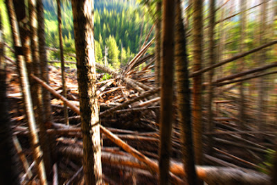
Whatever trail I was on, it eventually dead ended at the site of what appeared to be a giant tree explosion. Something had rolled down the hill and shattered the edge of the forest like – well, like that meteor that flattened a forest in Siberia.
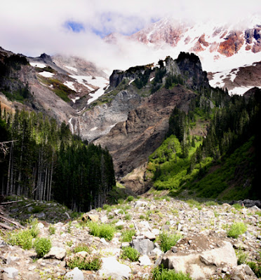
Ducking under and scrambling over downed trees, I emerged into an open valley that seemed subject to the same scouring forces that have wreaked disorder in the area around the Ramona Falls trail.
Standing in this pathway – this giant chute – I got the same sense of impending doom that I once got trying to cross a railroad bridge.

Occasionally, the mountain would peek at me from behind its white burqa, perhaps gauging how long it would take me to reach relative safety along the banks of the valley and preparing to let loose a house sized rock or two.
The devious Muddy Fork attempting to appear tame and docile - never-mind that it lurks at the bottom of vicious scar two stories deep.
 Hydraulics – a force continually underestimated.
I lose the trail. For awhile, I follow the streambed upward, but the looming unstable boulders in the freshly eroded banks make me uneasy. I eventually resort to following the tree-line on the left, but my growing uncertainty about the location of McNeil point soon has me questioning whether my labored efforts at climbing are cost effective.

This colorful flower suggests that the Muddy Fork is a giver of life.
On the way out, I stop to take pictures of Mt. Hood in the lengthening rays of the setting sun. I’m sitting on a path on the side of Bald Mountain that is nearly two thousand feet above the Muddy Fork valley. Suddenly, a guy that looks an awful lot like a photographer walks up from behind, catches a glimpse of a stunted tree branch on a dangerous slope and simply walks off the side of the trail (see photographer in lower right portion of image above).
In this picture, you can see the photographer setting up his camera. In the lower right corner you can see his pet mountain goat desperately clinging to the side of the cliff after it lost its footing – and just seconds before it plunged to its death - or maybe that’s just a rock.
Now I am jealous because the photographer is spending an awful lot of time composing his picture which I suppose will have a wonderfully evocative snag in the foreground leading the eye to the grandeur of the mountain.
“Damn it!” I say to myself. “I only have pictures from the path that everyone else and their uncle takes.”
Eventually, I decide that since I have no wonderfully evocative snag, I will at least document the taking of a photograph by a daring photographer. By walking further back on the trail, I see an unofficial side path that leads down to an outcrop of rocks on a patch of soft ground that is almost level. I end up using the other photographer as my foreground element.
I don’t want to miss the changing faces of the mountain, but I’m keenly aware that I will once again be stumbling back to the car in the dark over an unfamiliar trail. Additionally, the other photographer has just told me about the beautiful black bear he saw earlier in the day.
“Could you tell,” I ask, “did it look hungry?”

In the fading light, I ponder facts about bears with a new urgency. Are they nocturnal? Can they really run 35 miles an hour? Can they effortlessly climb trees using their great strength in combination with giant claws?
If that black bear finds me in the forest in the dark – I guess the only thing to do is poop my pants (likely this won't even have to be a voluntary response) and hope the smell ruins its appetite.


No comments:
Post a Comment